Best Day Trips From San Diego: A Local's Guide
From oak-shaded mountain towns to the Sonoran desert to a border city with its own culinary press, the best day trips from San Diego prove the region's depth extends well past the sand.
The marine layer still had a grip on Sunset Cliffs when I pulled out of Ocean Beach a little after six, wetsuit drying on the roof rack, coffee sweating in the cupholder. Ninety minutes later I was parked on Julian's Main Street in dry mountain air, sixty degrees and climbing, woodsmoke and apple pie drifting from a general store. That's the trick of this county: a morning of sand between your toes can end in oak forest, or in a border city that runs on its own rhythm entirely. Ask around for the best day trips from San Diego and you'll get five different answers, because the geography here doesn't sit still.
What follows is organized the way locals actually plan these trips: by compass heading. East into the mountains and desert. North up the coast. Further north into wine country and eventually Orange County. South, across a border that is not scenery but a working part of daily life for a huge share of this region. Every one of these places is real, reachable in a single day, and worth the gas. None of them require booking months out or committing to a whole weekend. Load the cooler, check the gas gauge, and pick a direction.
The Best Day Trips From San Diego, Sorted by Direction
San Diego County is enormous, roughly the size of Connecticut, and it climbs from sea level to over six thousand feet before dropping into true desert on the other side of the mountains. That's why a single afternoon can take you from fog to pine forest to sand dunes. The freeways locals use to get there all carry the definite article: the 5 runs the coast, the 8 cuts east through El Cajon toward the mountains and desert, the 15 threads north through wine country, and the 805 bypasses downtown for anyone headed toward the border crossings. Keep those in your head and the rest of this guide will make sense.
East to the Mountains: Julian and Mount Laguna
Julian
Julian started as a gold rush town in the 1870s and never fully let go of that identity, though these days it's apples, not ore, that draw the crowds. The town sits at around 4,200 feet in the Cuyamaca range, which means real seasons: dogwood and lilac in spring, apple harvest in fall, and the occasional dusting of snow in winter that sends San Diegans scrambling for tire chains they've never used. Wander Main Street for pie, cider, and small mining-town storefronts that haven't been flattened into anything corporate. Cuyamaca Rancho State Park sits just south with oak woodland trails and grassy meadows that recovered slowly after a major wildfire years back, a reminder that these mountains carry their own history of fire the way the coast carries its history of tides.
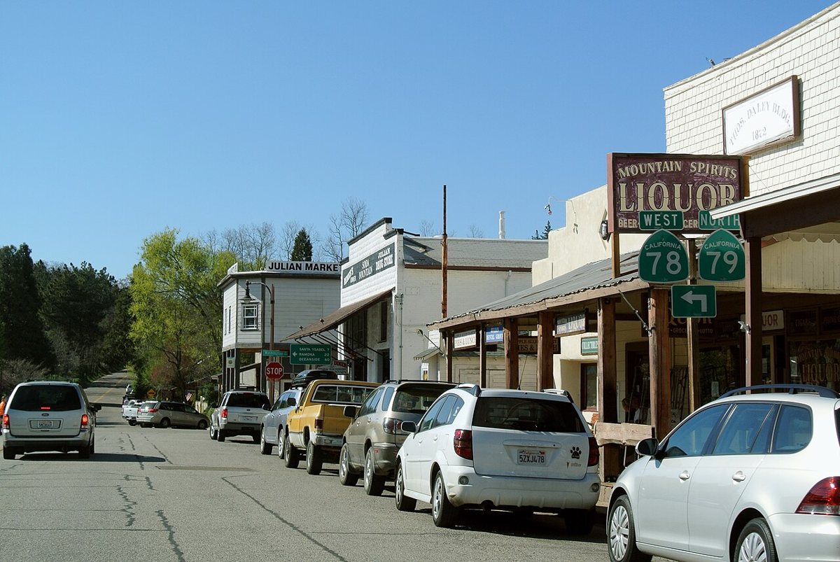

Insider tip: weekends get crowded fast, especially in fall. Go on a weekday morning if you can, and budget time to actually get out of the car and walk the side streets, not just the main strip. Drive time from central San Diego runs about seventy-five minutes via Highway 79 or Interstate 8 to 79, heading northeast.
Mount Laguna and the Sunrise Highway
Keep going east on the 8 past Alpine and you'll find the turnoff for Sunrise Highway, a two-lane road that climbs into the Laguna Mountains and delivers some of the best views in the county, high desert and the Anza-Borrego badlands falling away to the east, ocean haze to the west on a clear day. The Pacific Crest Trail crosses right through this stretch, so it's common to pass thru-hikers resupplying at the small store in the community of Mount Laguna. Pine forest at six thousand feet feels like a different state entirely, and the temperature swing from the coast can top thirty degrees on a summer afternoon. Stargazing here is genuinely good, thanks to elevation and distance from city light. Plan on roughly ninety minutes from downtown San Diego, and check road conditions in winter since snow closures do happen.
Into the Desert: Anza-Borrego and the Salton Sea
Anza-Borrego Desert State Park
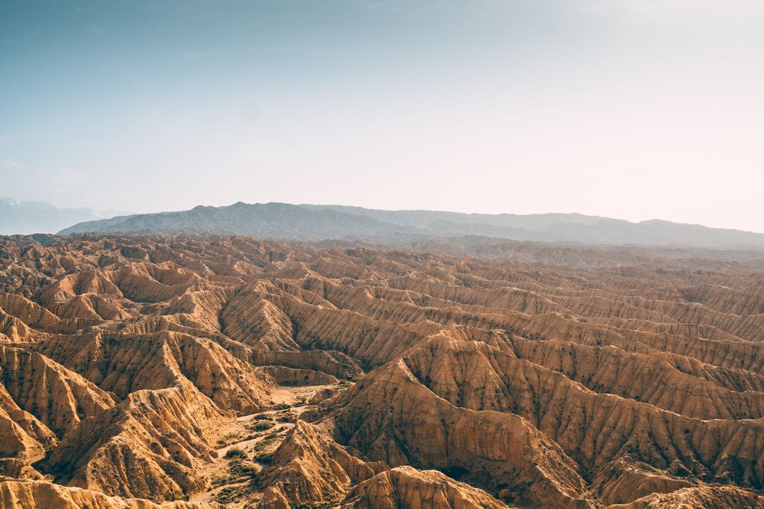
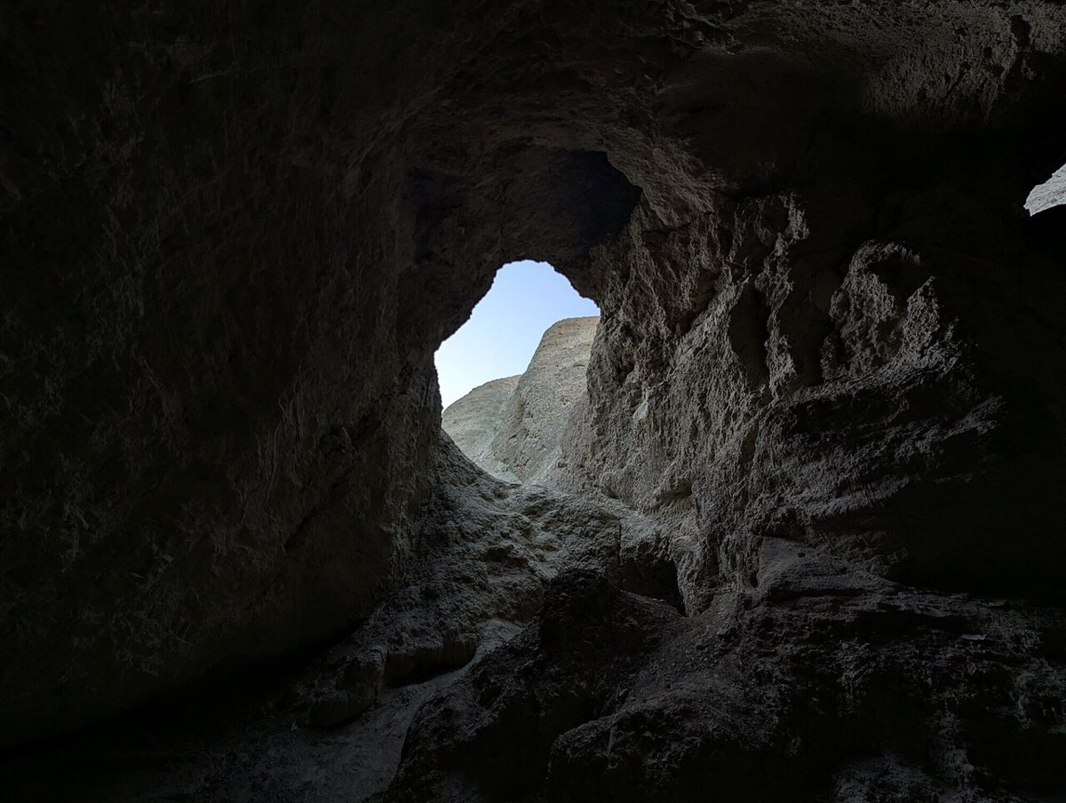
Anza-Borrego is the largest state park in California, and it's the payoff waiting on the far side of those mountain drives. The badlands around Borrego Springs look almost lunar, cut by washes and slot canyons that reward an early start before the heat sets in. Borrego Palm Canyon is a well-loved hike to a fan palm oasis fed by a year-round stream, a genuine surprise in a landscape this dry. Scattered across the desert floor near town are more than a hundred large metal sculptures by artist Ricardo Breceda, dinosaurs and camels and a giant sea serpent that appears to weave in and out of the sand, standing on private land that's open to the public, free to visit any time. In years with good winter rain, the desert floor turns gold and purple with wildflowers, though that's never guaranteed and worth checking on before you plan around it.

Insider tip: this is genuine desert, so bring more water than feels necessary and avoid midday hiking from late spring through early fall. Winter and early spring are the better windows. It's about two hours from central San Diego, generally via the 8 and Highway 79 through Julian, or the 15 and Highway 78 through Escondido.
The Salton Sea
Push another hour east past the mountains and the landscape changes again, into the Imperial Valley and California's largest lake, an accidental one, formed when the Colorado River breached an irrigation canal in the early 1900s. The Salton Sea has a complicated, sometimes grim modern story of shrinking shorelines and agricultural runoff, and it isn't a polished tourist stop. What it is, still, is one of the most important stopovers for migratory birds on the Pacific Flyway, and there's something genuinely strange and worth seeing about a vast inland sea surrounded by date farms and open desert. It's a trip for people curious about the region's harder edges, not a beach day. Insider tip: bring binoculars if you have them, since the shoreline draws pelicans, herons, and enormous flocks of migrating waterfowl that most visitors drive right past. It's roughly three hours from central San Diego via the 8 and Highway 86, best done as an extension of an Anza-Borrego trip rather than a stop on its own.
North to Palomar Mountain
Palomar Mountain rises out of North County's back-country between Escondido and Temecula, and it's home to Palomar Observatory, operated by Caltech, whose two-hundred-inch Hale Telescope was for decades among the largest in the world. The visitor gallery lets you see the telescope up close, and the surrounding Palomar Mountain State Park has cedar and fir forest that feels closer to the Sierra than anything you'd expect an hour from the coast. Families come for the picnic areas and short nature trails; astronomy buffs come for the history of the place, since discoveries made here reshaped how astronomers understood the scale of the universe.
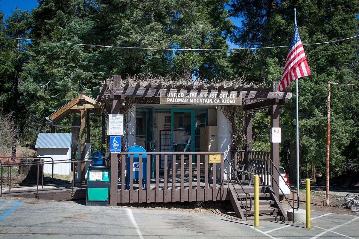

Insider tip: the drive up Highway 76 to South Grade Road involves a lot of switchbacks, so this isn't the trip for anyone prone to carsickness. Give yourself around ninety minutes from central San Diego via the 15 north.
Up the North Coast: Encinitas, Carlsbad, Oceanside
Encinitas
Encinitas is a surf town in the most literal sense, home to Swami's, one of the more storied point breaks on the coast, and to the gold lotus domes of the Self-Realization Fellowship hermitage, built by followers of Paramahansa Yogananda and still drawing quiet visitors to its cliffside meditation gardens overlooking the Pacific. Downtown Encinitas is walkable and unfussy, coffee shops and surf shops mixed in with longtime local businesses. The San Diego Botanic Garden sits just inland with acres of bamboo, desert, and subtropical plantings across winding paths.
Insider tip: park in the free lots near Moonlight Beach and walk south along the bluffs rather than fighting for coastal parking near Swami's on a weekend. It's about half an hour north on the 5.
Carlsbad
Carlsbad splits neatly into a low-key beach village and a family-trip juggernaut, and both are worth the drive for different reasons. The Flower Fields at Carlsbad Ranch turn a hillside above the freeway into sheets of ranunculus color each spring, visible even from passing cars on the 5. Legoland California anchors the family-trip side of town, and Carlsbad Village itself has a compact, easy-to-walk downtown near the train station with a growing list of craft breweries worth a stop.
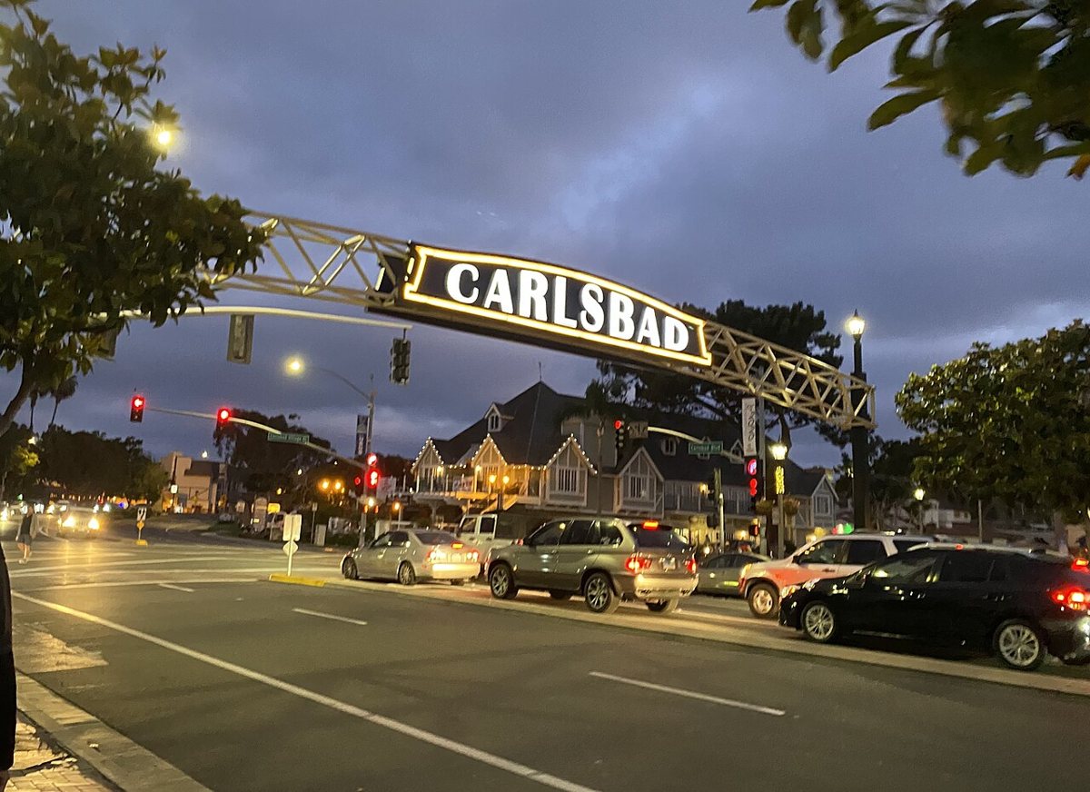

Insider tip: the state beach parking lots fill early on summer weekends, so aim for a weekday or get there before nine. Carlsbad is roughly thirty-five minutes north via the 5.
Oceanside
Oceanside doesn't get the credit it deserves. It has the longest wooden pier on the West Coast, a genuinely good surf museum in the California Surf Museum, and a working harbor with fresh fish stands that feel a world away from the resort towns just south. Inland a few miles sits Mission San Luis Rey, the largest of California's historic missions, still an active parish with quiet gardens open to visitors. Oceanside's downtown has leaned hard into its brewery scene in recent years, a smaller cousin of the craft beer trail San Diego built its national reputation on, and the pier itself is free to walk out on any day of the year, with pelicans diving for bait fish alongside the anglers.
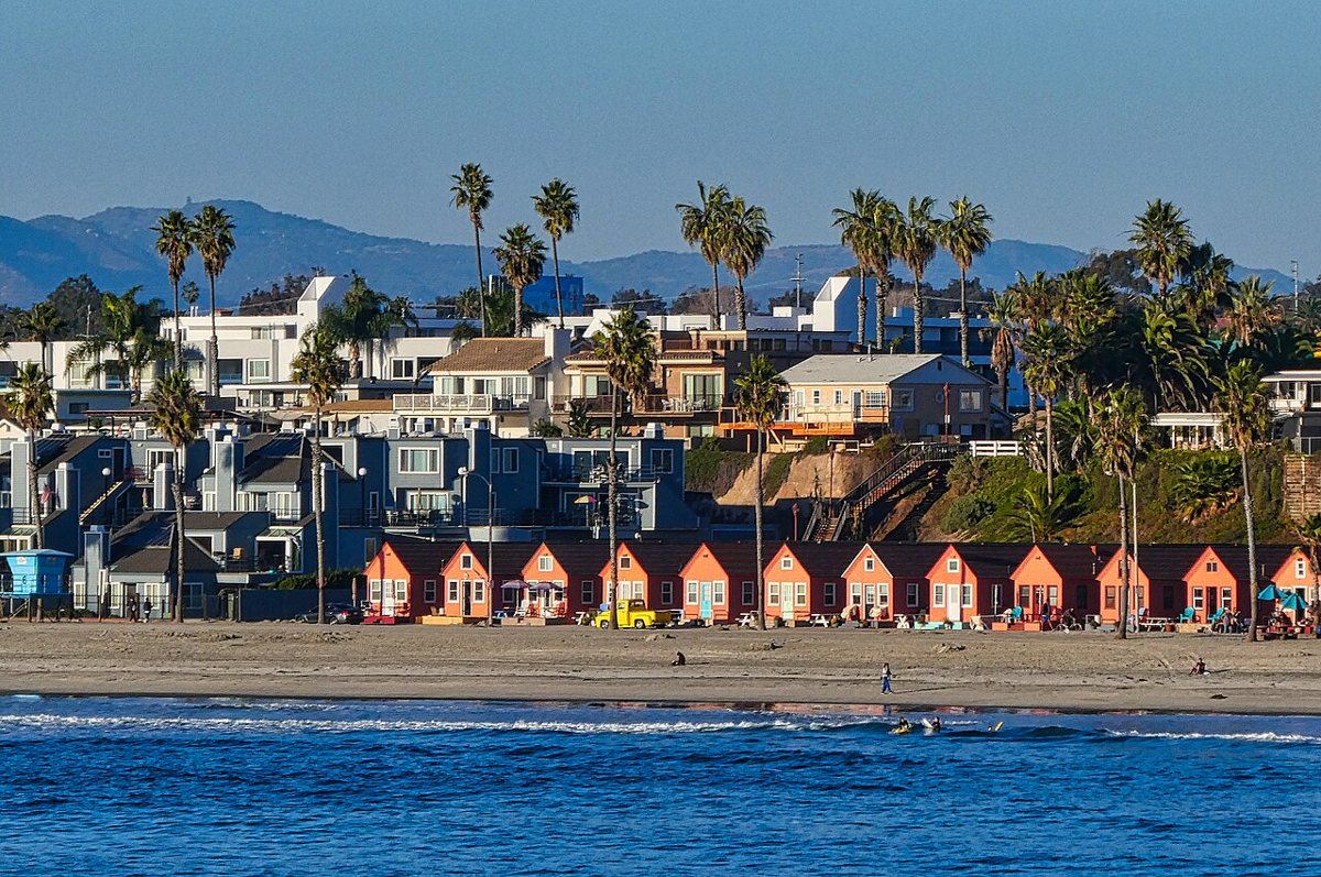

Insider tip: come at sunset. The pier faces west and the light off the water is better than almost anywhere else on this stretch of coast. Oceanside runs about forty minutes north on the 5.
Wine Country: Temecula
Temecula sits just over the county line in Riverside County but functions, for practical purposes, as San Diego's wine country, close enough for a full day trip without an overnight. Rancho California Road threads through dozens of wineries on rolling hills that catch a cooling breeze off the coast, unusual enough at this latitude that it supports a real wine industry. Old Town Temecula keeps a Western-storefront feel with antique shops and restaurants, and hot air balloons drift over the vineyards most clear mornings, a fixture of the valley's early-morning skyline.
Insider tip: book a designated driver or a tour van if you plan to taste at more than one stop, since the wineries are spread out along a road with real curves. It's about an hour north via the 15.
South of the Border: Tijuana
No honest guide to day trips from this region skips Tijuana, and no honest local treats the crossing as a novelty. This is a genuine binational region, families and workers and students moving across the line daily, and Tijuana itself is a serious food and arts city, not a backdrop for someone else's story about the border. Avenida Revolución still has its tourist strip, but the real draw now is a food scene that has earned international attention, chefs working in Baja Med cuisine that blends Pacific seafood, Mediterranean technique, and Mexican tradition. Caesar salad was invented at a restaurant here, and that history is still on the menu. The Centro Cultural Tijuana, known locally as CECUT, anchors a genuine arts scene with its distinctive spherical Omnimax theater, and Telefónica Gastro Park brings together a rotating lineup of food trucks and small breweries in a converted lot that captures how much the city's culinary identity has grown. Tijuana has its own craft beer scene too, one that grew up alongside San Diego's rather than in its shadow, and comparing notes between breweries on both sides of the line is its own kind of day trip.
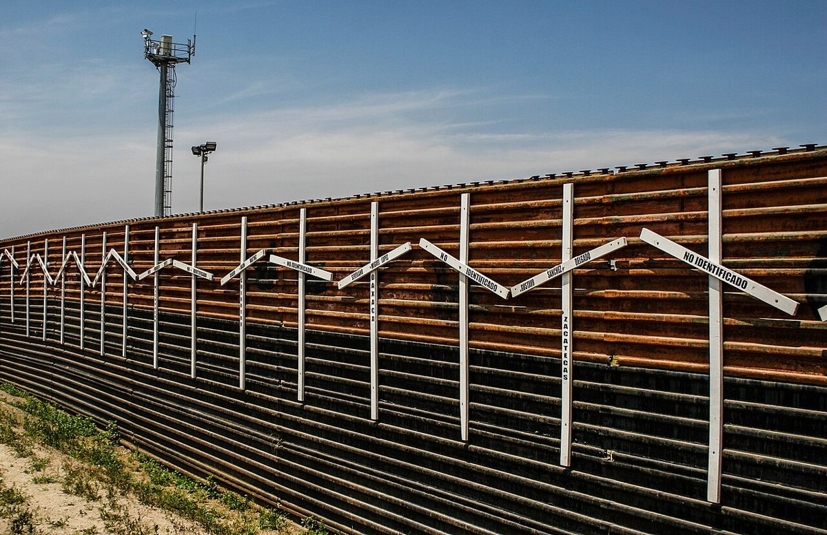

Crossing on foot through the San Ysidro Port of Entry, the busiest land border crossing in the Western Hemisphere, is generally the simplest way to spend the day in Tijuana without worrying about a car. A valid passport or passport card is required for the return trip into the United States, no exceptions, and lines back into San Diego can run long, especially on weekend afternoons and evenings; the pedestrian lanes typically move faster than vehicle lanes at peak times. For readers who want the fuller logistics, our guide to crossing the border into Tijuana breaks down the pedestrian versus vehicle options in more detail.
North Into Orange County: Laguna Beach and the Mission
Laguna Beach
Laguna Beach sits a couple hours north up the 5, technically Orange County territory but close enough that plenty of San Diegans treat it as their own occasional escape. It built its identity as an art colony a century ago and still carries that reputation, with galleries lining the Pacific Coast Highway and a long summer arts festival tradition. The real draw for a day trip is the coastline itself, a string of coves and tide pools carved into sandstone cliffs, each one with its own character and its own regulars.
Insider tip: skip the main beach downtown and walk a few blocks to one of the smaller coves for tide pooling at low tide. Figure close to two hours each way depending on traffic on the 5, and this is one trip where checking traffic before you leave actually matters.
San Juan Capistrano and Dana Point
A little south of Laguna, Mission San Juan Capistrano is one of the most photographed of California's historic missions, known for its ruined stone church and, in local legend, for the cliff swallows that return each spring. Just down the road, Dana Point's harbor is one of the better spots on the Southern California coast for whale watching, with gray whales passing offshore on their migration in winter and early spring and other species visible through much of the year. Doheny State Beach nearby has calmer water than most of the coast up here, good for an easy afternoon after a morning at the mission.
The Practical Stuff: Freeways, the Border, and Timing
Almost everything in this guide runs off four freeways. The 5 hugs the coast and handles both the north coast towns and the run up to Orange County; the 8 heads straight east toward the mountains and desert; the 15 goes north through the inland valleys toward Temecula and connects to Palomar; and the 805 is the faster bypass for anyone heading toward the San Ysidro or Otay Mesa border crossings, skirting downtown traffic. Weekday mornings before eight and Friday afternoons are the worst times to be on any of them.
For the border, bring a passport or passport card, not just a driver's license, for the return trip. Crossing on foot is almost always faster than driving, particularly at San Ysidro during peak weekend hours, and the newer PedWest facility on the west side of the San Ysidro crossing tends to move quicker than the older pedestrian bridge. If you're driving into Mexico, know that Mexican auto insurance is a separate policy from your U.S. coverage and worth arranging ahead of time. Locals who cross often invest in a trusted traveler program that shortens the wait considerably, though for an occasional day trip walking is usually the simpler call. Either way, build slack into your return time. A crossing that takes twenty minutes on a Tuesday morning can take well over an hour on a Sunday evening.
Timing matters more in the desert and mountains than anywhere else on this list. Anza-Borrego and the Salton Sea are brutal in summer, best saved for late fall through early spring, while Julian, Mount Laguna, and Palomar Mountain can see snow and occasional road closures in winter. The coast towns work nearly any month, though June brings the marine layer locals call "June gloom," which usually burns off by early afternoon.
- Free and low-cost options: the Galleta Meadows sculptures near Borrego Springs, walking the Oceanside Pier, tide pooling at Laguna's smaller coves, the gardens at Mission San Juan Capistrano and the Self-Realization Fellowship hermitage in Encinitas, and simply driving Sunrise Highway for the views.
- Bring cash in small denominations for parking in Julian and for vendors in Tijuana.
- Fill your gas tank before heading into the desert or the mountains; stations thin out fast past Julian and Borrego Springs.
None of this requires an overnight bag. Every place in this guide is a there-and-back within a single day, which is the whole point. This county rewards people willing to actually leave it for an afternoon, whether that means climbing into pine forest an hour from the beach or walking a market street in a city that has its own rhythm entirely separate from San Diego's. The coast is real and it's beautiful and it is not the whole story, not even close. Go east until the air goes dry, go north until the vineyards start, or go south and order the Caesar salad where it was actually invented. The county, and the country just past it, is bigger than the part visible from the pier.